Places
115 places, each read through five lenses: why it’s unique, culture and history, placemaking, diving and water, photography.
06.1
Chart
05.2
Index
The South Pacific and Micronesia
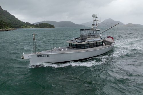 Bay of Islands and Whangarei, New Zealand
The voyage begins where modern New Zealand began.
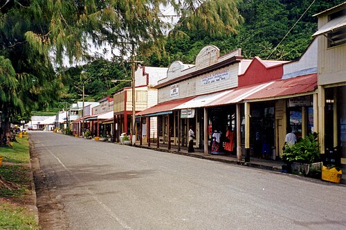 FijiSavusavu, Taveuni, Lau Group, Yasawas
More than 330 islands, about a third of them inhabited, where village protocol still governs how a visitor arrives.
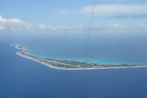 Tuvalu and KiribatiFunafuti and Tarawa
Two nations of low coral atolls strung along the equator, nowhere more than a few metres above the sea.
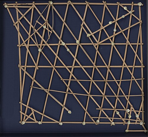 Marshall IslandsMajuro
Twenty-nine atolls and five islands scattered across about 2 million km² of ocean, with an average height of about 2 m above the sea.
 Pohnpei
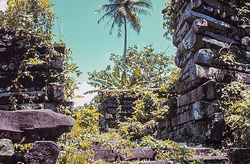
Nan Madol, a city of nearly 100 artificial islets built of basalt on the reef off Temwen Island, is one of the great archaeological sites of the Pacific (UNESCO, 2016).
 Kosrae
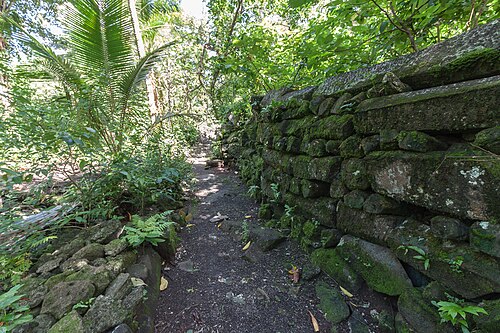
A high, rainforested volcanic island that very few travellers reach.
 Chuuk (Truk Lagoon)
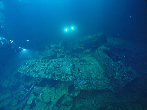
A lagoon of about 2,100 km² holding the world’s greatest concentration of Second World War wrecks.
 Yap
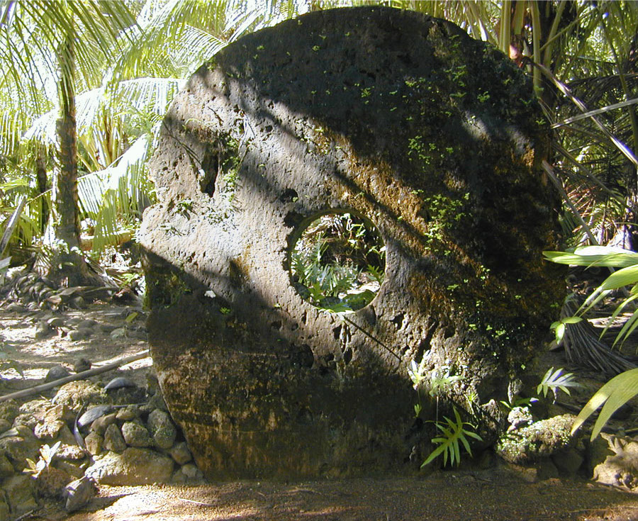
The home of rai, stone money: limestone discs up to about 3.5 m across, quarried in Palau and carried 400 km by canoe and raft.
 Palau
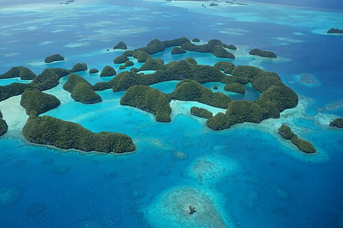
The Rock Islands Southern Lagoon (UNESCO, 2012), about 445 uninhabited limestone islands shaped like mushrooms by the sea.
Bay of Islands and Whangarei, New Zealand
The voyage begins where modern New Zealand began.
FijiSavusavu, Taveuni, Lau Group, Yasawas
More than 330 islands, about a third of them inhabited, where village protocol still governs how a visitor arrives.
Tuvalu and KiribatiFunafuti and Tarawa
Two nations of low coral atolls strung along the equator, nowhere more than a few metres above the sea.
Marshall IslandsMajuro
Twenty-nine atolls and five islands scattered across about 2 million km² of ocean, with an average height of about 2 m above the sea.
Pohnpei
Nan Madol, a city of nearly 100 artificial islets built of basalt on the reef off Temwen Island, is one of the great archaeological sites of the Pacific (UNESCO, 2016).
Kosrae
A high, rainforested volcanic island that very few travellers reach.
Chuuk (Truk Lagoon)
A lagoon of about 2,100 km² holding the world’s greatest concentration of Second World War wrecks.
Yap
The home of rai, stone money: limestone discs up to about 3.5 m across, quarried in Palau and carried 400 km by canoe and raft.
Palau
The Rock Islands Southern Lagoon (UNESCO, 2012), about 445 uninhabited limestone islands shaped like mushrooms by the sea.
Japan and the China seas
 Okinawa and Ishigaki
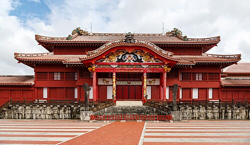
The Ryukyu Kingdom (1429–1879) was an independent trading state between China, Japan and Southeast Asia, with a culture distinct from mainland Japan.
 KyushuKagoshima, Nagasaki
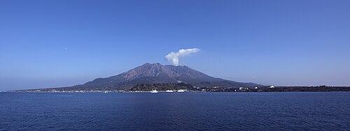
Sakurajima, one of Japan’s most active volcanoes, erupts many times a year across the bay from Kagoshima, a city of about 600,000 people where the weather forecast includes the direction of the ash.
 Seto Inland SeaHiroshima, Miyajima, Naoshima, Teshima, Onomichi
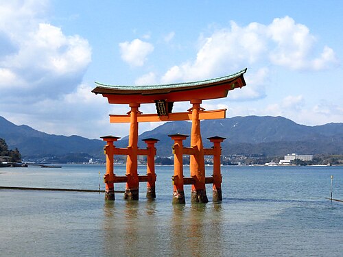
More than 700 islands in a calm inland sea that became one of Japan’s first national parks in 1934.
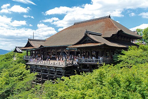 Kyoto and Nara (by train from Osaka)
Kyoto was Japan’s imperial capital from 794 to 1868 and alone has 17 UNESCO sites.
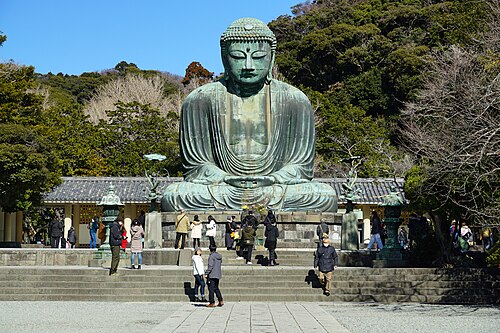 Kamakura and Tokyo
Greater Tokyo, with about 37 million people, is the largest metropolitan area in the world, yet much of it is built at the scale of small streets and neighbourhoods.
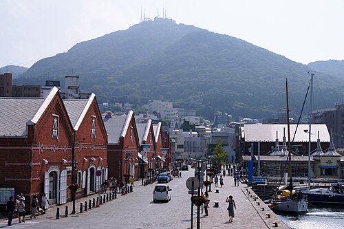 Tohoku and HokkaidoHakodate
The Sanriku coast of Tohoku was devastated by the tsunami of March 2011 and has since been rebuilt in very different ways, making it an open-air study of recovery.
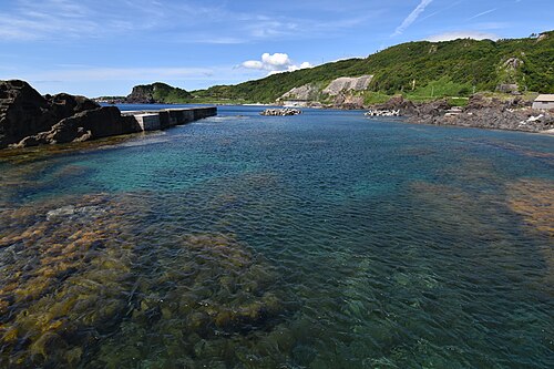 The Sea of Japan coastSado, Kanazawa and Oki
The quiet back coast of Honshu, facing Korea and Russia across a sea that foreigners seldom cross.
 KoreaBusan, Gyeongju and Jeju
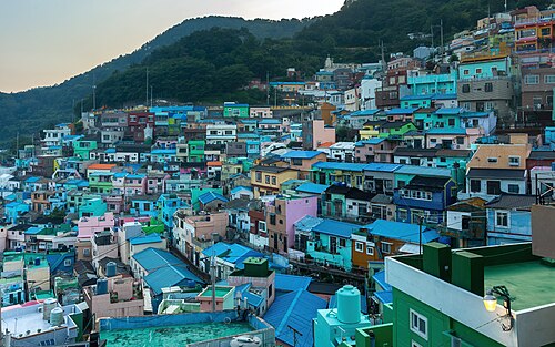
A day’s passage from Japan lies a different civilisation: a mountainous peninsula with its own script, its own cuisine and a port city of four million built up steep hillsides.
 TaiwanKaohsiung, Tainan and Penghu
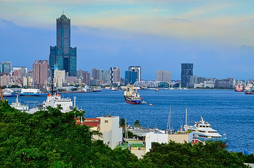
An island of high mountains and dense cities, and the place where most of the world’s motor yachts of RAW’s size are built.
 Hong Kong and Macau
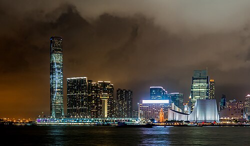
A harbour city of seven million on a drowned coast of more than two hundred islands.
 The PhilippinesSubic Bay and Palawan
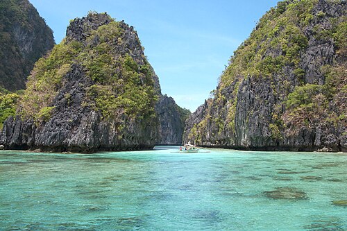
Seven thousand islands at the centre of the world’s marine life.
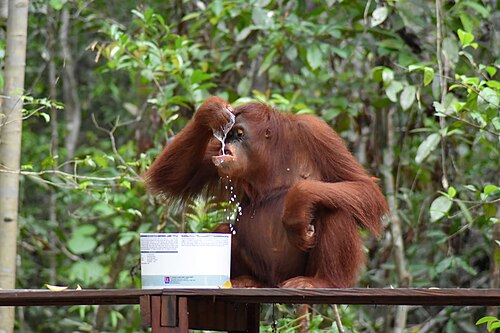 BorneoKota Kinabalu, Brunei, Kuching and Kumai
The third largest island on Earth, shared by Malaysia, Brunei and Indonesia, with rainforest older than the Amazon.
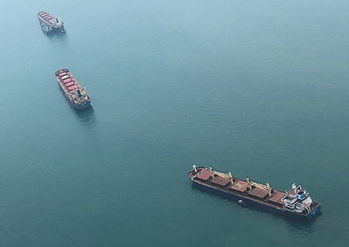 Singapore and the Strait of Malacca
One of the great sea roads of the world, six hundred miles long and in places a few miles wide.
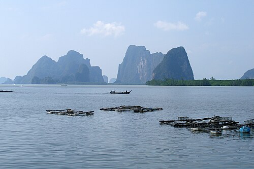 Phuket and Phang Nga Bay
Thailand’s largest island, and beside it a bay of limestone towers rising straight out of a shallow green sea.
Okinawa and Ishigaki
The Ryukyu Kingdom (1429–1879) was an independent trading state between China, Japan and Southeast Asia, with a culture distinct from mainland Japan.
KyushuKagoshima, Nagasaki
Sakurajima, one of Japan’s most active volcanoes, erupts many times a year across the bay from Kagoshima, a city of about 600,000 people where the weather forecast includes the direction of the ash.
Seto Inland SeaHiroshima, Miyajima, Naoshima, Teshima, Onomichi
More than 700 islands in a calm inland sea that became one of Japan’s first national parks in 1934.
Kyoto and Nara (by train from Osaka)
Kyoto was Japan’s imperial capital from 794 to 1868 and alone has 17 UNESCO sites.
Kamakura and Tokyo
Greater Tokyo, with about 37 million people, is the largest metropolitan area in the world, yet much of it is built at the scale of small streets and neighbourhoods.
Tohoku and HokkaidoHakodate
The Sanriku coast of Tohoku was devastated by the tsunami of March 2011 and has since been rebuilt in very different ways, making it an open-air study of recovery.
The Sea of Japan coastSado, Kanazawa and Oki
The quiet back coast of Honshu, facing Korea and Russia across a sea that foreigners seldom cross.
KoreaBusan, Gyeongju and Jeju
A day’s passage from Japan lies a different civilisation: a mountainous peninsula with its own script, its own cuisine and a port city of four million built up steep hillsides.
TaiwanKaohsiung, Tainan and Penghu
An island of high mountains and dense cities, and the place where most of the world’s motor yachts of RAW’s size are built.
Hong Kong and Macau
A harbour city of seven million on a drowned coast of more than two hundred islands.
The PhilippinesSubic Bay and Palawan
Seven thousand islands at the centre of the world’s marine life.
BorneoKota Kinabalu, Brunei, Kuching and Kumai
The third largest island on Earth, shared by Malaysia, Brunei and Indonesia, with rainforest older than the Amazon.
Singapore and the Strait of Malacca
One of the great sea roads of the world, six hundred miles long and in places a few miles wide.
Phuket and Phang Nga Bay
Thailand’s largest island, and beside it a bay of limestone towers rising straight out of a shallow green sea.
The Indian Ocean, Africa and the Atlantic home
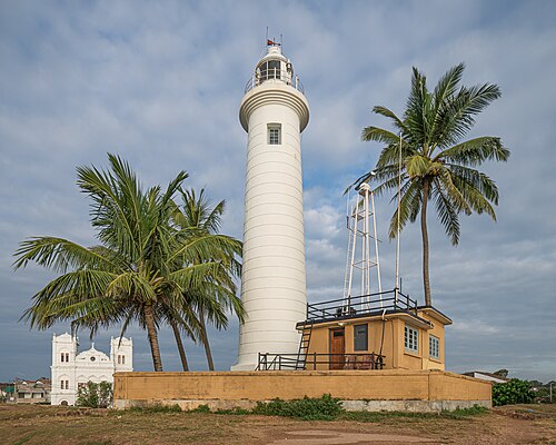 Sri LankaGalle, Trincomalee and the hill country
An island at the turning point of the Indian Ocean, visited by every sailing nation for two thousand years.
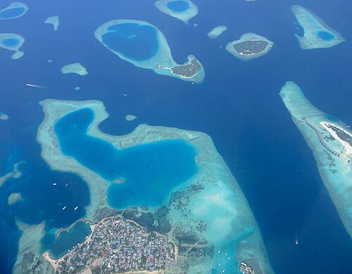 The Maldives
Twelve hundred coral islands in a double chain of twenty-six atolls, nowhere more than two metres high.
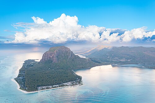 The MascarenesRodrigues, Mauritius and Réunion
Three volcanic islands alone in the south-west Indian Ocean, uninhabited until Europeans came.
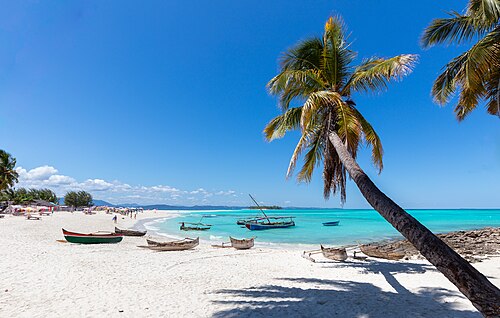 MadagascarSainte-Marie and Nosy Be
The fourth largest island in the world, apart from Africa for eighty million years.
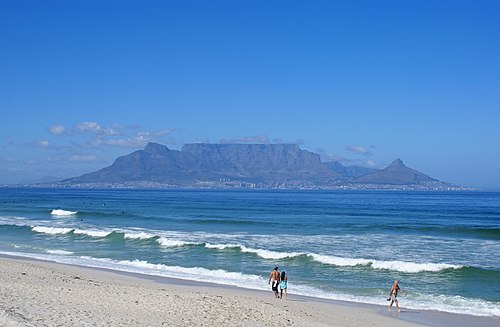 South AfricaZululand to Cape Town
The southern end of Africa, where the Indian and Atlantic oceans meet.
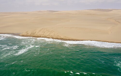 NamibiaLüderitz and Walvis Bay
A coast where the oldest desert in the world meets a cold ocean.
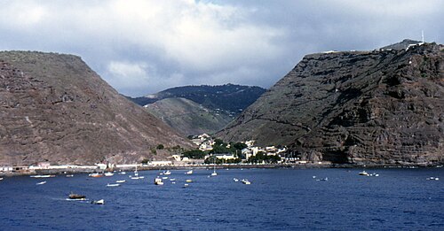 St Helena and Ascension
Two specks in the middle of the South Atlantic, among the most remote inhabited islands on Earth.
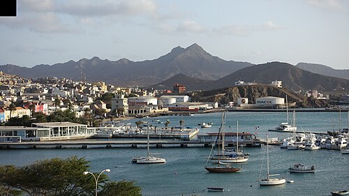 Cape VerdeMindelo, Santo Antão, Cidade Velha
Ten volcanic islands off West Africa with a Creole culture of their own.
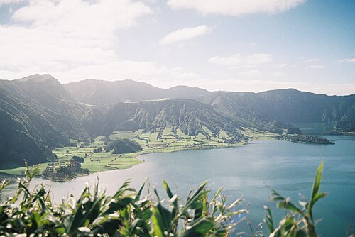 AzoresSão Miguel, Terceira, Faial, Pico
Nine volcanic islands where three tectonic plates meet in the middle of the Atlantic.
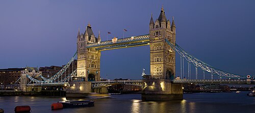 EnglandFalmouth, the Solent and London
The south coast of England, from the granite harbours of Cornwall to the capital, reached by its river.
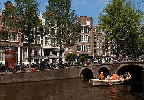 Amsterdam
The 17th-century canal ring (UNESCO), built on land below sea level, in a city where bicycles outnumber people.
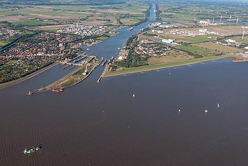 Kiel Canal and the Danish islands
The Kiel Canal (1895), about 98 km long, is the world’s busiest artificial waterway, cutting across Schleswig-Holstein between the North Sea and the Baltic.
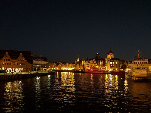 The southern BalticBornholm, Karlskrona and Gdańsk
The home sea: short passages between old trading towns on a tideless, brackish sea.
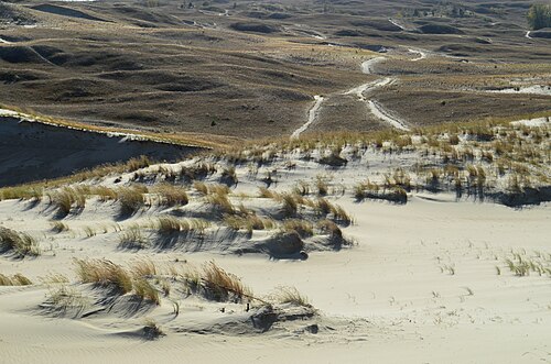 Klaipėda and the Curonian Spit
Lithuania’s only seaport and RAW’s home, at the gateway to the Curonian Spit (UNESCO), a 98 km sand peninsula of high dunes and pine forest shared with Russia’s Kaliningrad region.
Sri LankaGalle, Trincomalee and the hill country
An island at the turning point of the Indian Ocean, visited by every sailing nation for two thousand years.
The Maldives
Twelve hundred coral islands in a double chain of twenty-six atolls, nowhere more than two metres high.
The MascarenesRodrigues, Mauritius and Réunion
Three volcanic islands alone in the south-west Indian Ocean, uninhabited until Europeans came.
MadagascarSainte-Marie and Nosy Be
The fourth largest island in the world, apart from Africa for eighty million years.
South AfricaZululand to Cape Town
The southern end of Africa, where the Indian and Atlantic oceans meet.
NamibiaLüderitz and Walvis Bay
A coast where the oldest desert in the world meets a cold ocean.
St Helena and Ascension
Two specks in the middle of the South Atlantic, among the most remote inhabited islands on Earth.
Cape VerdeMindelo, Santo Antão, Cidade Velha
Ten volcanic islands off West Africa with a Creole culture of their own.
AzoresSão Miguel, Terceira, Faial, Pico
Nine volcanic islands where three tectonic plates meet in the middle of the Atlantic.
EnglandFalmouth, the Solent and London
The south coast of England, from the granite harbours of Cornwall to the capital, reached by its river.
Amsterdam
The 17th-century canal ring (UNESCO), built on land below sea level, in a city where bicycles outnumber people.
Kiel Canal and the Danish islands
The Kiel Canal (1895), about 98 km long, is the world’s busiest artificial waterway, cutting across Schleswig-Holstein between the North Sea and the Baltic.
The southern BalticBornholm, Karlskrona and Gdańsk
The home sea: short passages between old trading towns on a tideless, brackish sea.
Klaipėda and the Curonian Spit
Lithuania’s only seaport and RAW’s home, at the gateway to the Curonian Spit (UNESCO), a 98 km sand peninsula of high dunes and pine forest shared with Russia’s Kaliningrad region.
The Arctic and North America
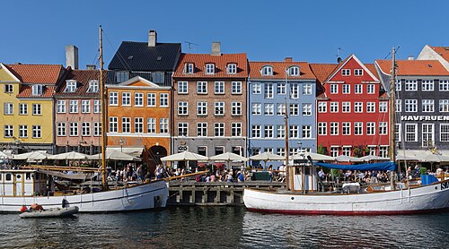 Copenhagen and the Sound
A capital built on harbours and canals, where a boat can lie in the middle of the city.
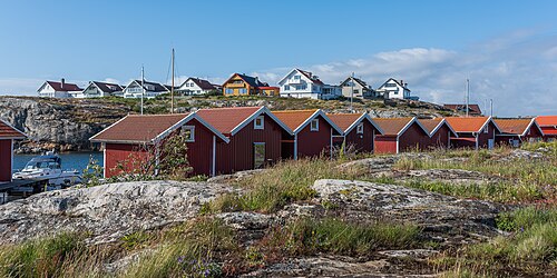 Gothenburg and the Bohuslän coast
Sweden’s west coast: a port city built by Dutch engineers on canals, and north of it a thousand bare granite islands with red boathouses in every cleft.
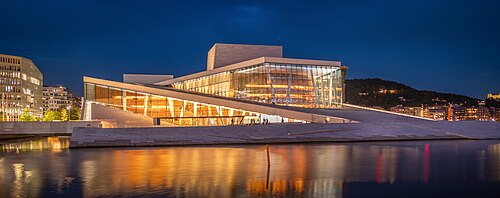 Oslo and southern Norway
A capital at the head of a wooded fjord, and beyond it a coast of white wooden towns behind a screen of skerries.
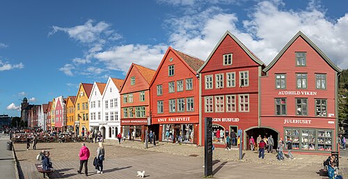 Bergen, Ålesund and the Geirangerfjord
The Geirangerfjord, with the Nærøyfjord, is a UNESCO site of steep walls and waterfalls.
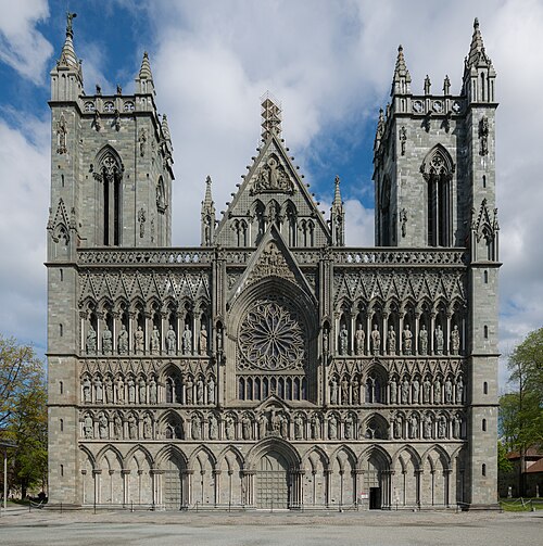 Trondheim
Nidaros Cathedral, built over the grave of St Olav, is the northernmost medieval cathedral in the world and Norway’s coronation church.
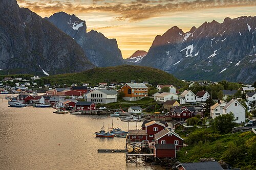 Lofoten
Granite peaks rising straight out of the sea, well above the Arctic Circle but kept mild by the Gulf Stream.
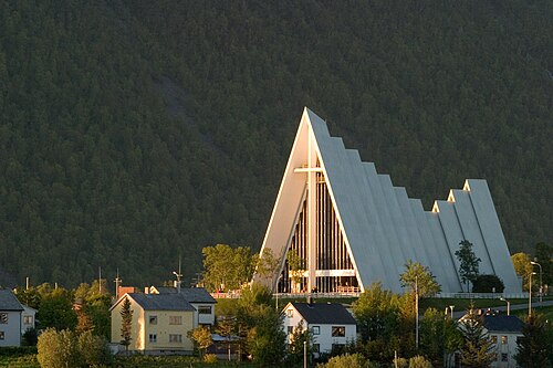 Tromsø
The largest city in northern Norway and the traditional gateway to the Arctic, from which many polar expeditions departed.
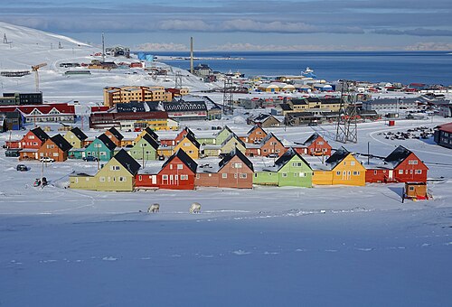 Svalbard
Longyearbyen is the northernmost town in the world with more than 1,000 people.
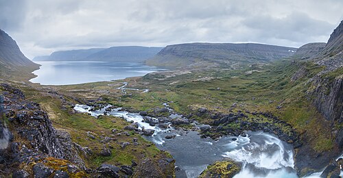 Iceland
An island of fire and ice on the mid-Atlantic ridge, where the Earth’s crust is being made.
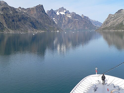 South Greenland
The southern tip of the world’s largest island: fjords, glaciers and icebergs, and green valleys that gave the country its name.
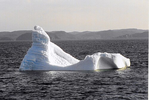 Newfoundland and Saint-Pierre
The eastern edge of North America, an island of rock, bog and fog on the Grand Banks.
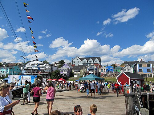 Nova ScotiaCape Breton, Halifax and Lunenburg
A peninsula of a thousand coves, the home of the Grand Banks schooners.
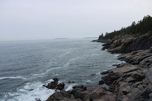 New EnglandMaine to Newport
A coast of granite islands, spruce and wooden towns.
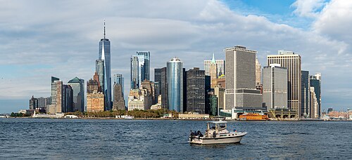 New York
The city is a port: an archipelago at the mouth of the Hudson, with five hundred miles of shoreline.
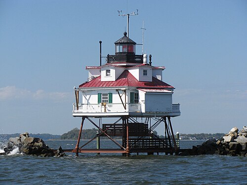 Chesapeake BayAnnapolis and Washington
The largest estuary in the United States, two hundred miles long and mostly shallow.
Copenhagen and the Sound
A capital built on harbours and canals, where a boat can lie in the middle of the city.
Gothenburg and the Bohuslän coast
Sweden’s west coast: a port city built by Dutch engineers on canals, and north of it a thousand bare granite islands with red boathouses in every cleft.
Oslo and southern Norway
A capital at the head of a wooded fjord, and beyond it a coast of white wooden towns behind a screen of skerries.
Bergen, Ålesund and the Geirangerfjord
The Geirangerfjord, with the Nærøyfjord, is a UNESCO site of steep walls and waterfalls.
Trondheim
Nidaros Cathedral, built over the grave of St Olav, is the northernmost medieval cathedral in the world and Norway’s coronation church.
Lofoten
Granite peaks rising straight out of the sea, well above the Arctic Circle but kept mild by the Gulf Stream.
Tromsø
The largest city in northern Norway and the traditional gateway to the Arctic, from which many polar expeditions departed.
Svalbard
Longyearbyen is the northernmost town in the world with more than 1,000 people.
Iceland
An island of fire and ice on the mid-Atlantic ridge, where the Earth’s crust is being made.
South Greenland
The southern tip of the world’s largest island: fjords, glaciers and icebergs, and green valleys that gave the country its name.
Newfoundland and Saint-Pierre
The eastern edge of North America, an island of rock, bog and fog on the Grand Banks.
Nova ScotiaCape Breton, Halifax and Lunenburg
A peninsula of a thousand coves, the home of the Grand Banks schooners.
New EnglandMaine to Newport
A coast of granite islands, spruce and wooden towns.
New York
The city is a port: an archipelago at the mouth of the Hudson, with five hundred miles of shoreline.
Chesapeake BayAnnapolis and Washington
The largest estuary in the United States, two hundred miles long and mostly shallow.
The Caribbean and Brazil
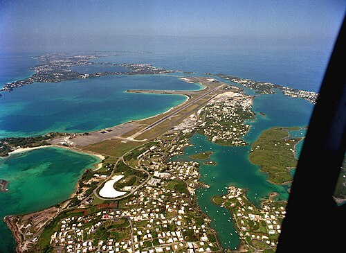 Bermuda
A hook of low islands alone in the western Atlantic, on the northernmost coral reefs in the world.
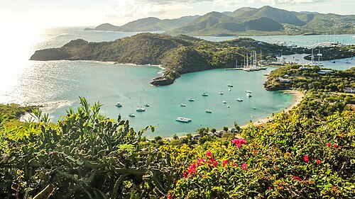 Antigua, Guadeloupe and Dominica
The northern arc of the Lesser Antilles: a low coral island, a French volcanic one and Dominica, the wildest and least developed of the chain.
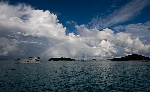 Martinique to Grenada and Tobago
The southern arc of the chain: steep green islands a day apart, and between them the Grenadines, thirty small islands behind reefs.
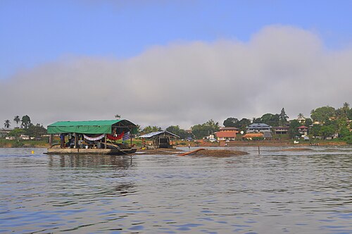 The GuianasSuriname and French Guiana
The forgotten coast of South America: brown rivers, mangrove and unbroken forest.
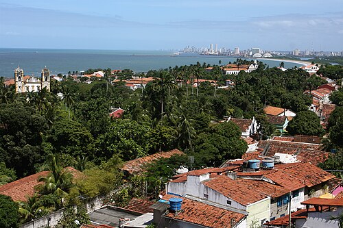 North-east BrazilParaíba and Olinda
The easternmost corner of the Americas, where the continent turns south.
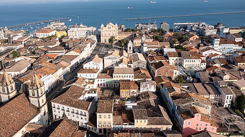 Salvador
Brazil’s first capital (1549–1763) and the heart of Afro-Brazilian culture, often called the most African city outside Africa.
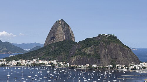 Rio de Janeiro
In 2012, Rio became the first city landscape on the UNESCO list, for the way mountains, forest and sea shape the city.
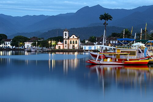 Ilha Grande and Paraty
Paraty and Ilha Grande were Brazil’s first mixed cultural and natural UNESCO site (2019), joining a colonial town with Atlantic rainforest and islands.
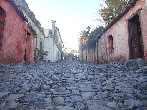 UruguayColonia, Montevideo, Punta del Este
Colonia del Sacramento, founded by the Portuguese in 1680 and fought over by Spain for a century, is a UNESCO site.
Bermuda
A hook of low islands alone in the western Atlantic, on the northernmost coral reefs in the world.
Antigua, Guadeloupe and Dominica
The northern arc of the Lesser Antilles: a low coral island, a French volcanic one and Dominica, the wildest and least developed of the chain.
Martinique to Grenada and Tobago
The southern arc of the chain: steep green islands a day apart, and between them the Grenadines, thirty small islands behind reefs.
The GuianasSuriname and French Guiana
The forgotten coast of South America: brown rivers, mangrove and unbroken forest.
North-east BrazilParaíba and Olinda
The easternmost corner of the Americas, where the continent turns south.
Salvador
Brazil’s first capital (1549–1763) and the heart of Afro-Brazilian culture, often called the most African city outside Africa.
Rio de Janeiro
In 2012, Rio became the first city landscape on the UNESCO list, for the way mountains, forest and sea shape the city.
Ilha Grande and Paraty
Paraty and Ilha Grande were Brazil’s first mixed cultural and natural UNESCO site (2019), joining a colonial town with Atlantic rainforest and islands.
UruguayColonia, Montevideo, Punta del Este
Colonia del Sacramento, founded by the Portuguese in 1680 and fought over by Spain for a century, is a UNESCO site.
Patagonia, Antarctica and the Pacific
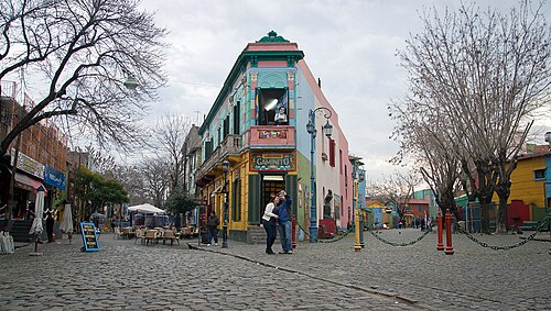 Buenos Aires
The city of tango (UNESCO, shared with Montevideo), shaped by waves of European immigration, and one of the world’s great café and bookshop cities.
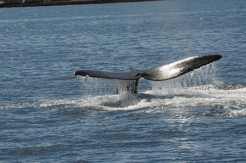 Puerto Madryn, Península Valdés and Gaiman
Península Valdés (UNESCO) is one of the great marine wildlife sites of the world.
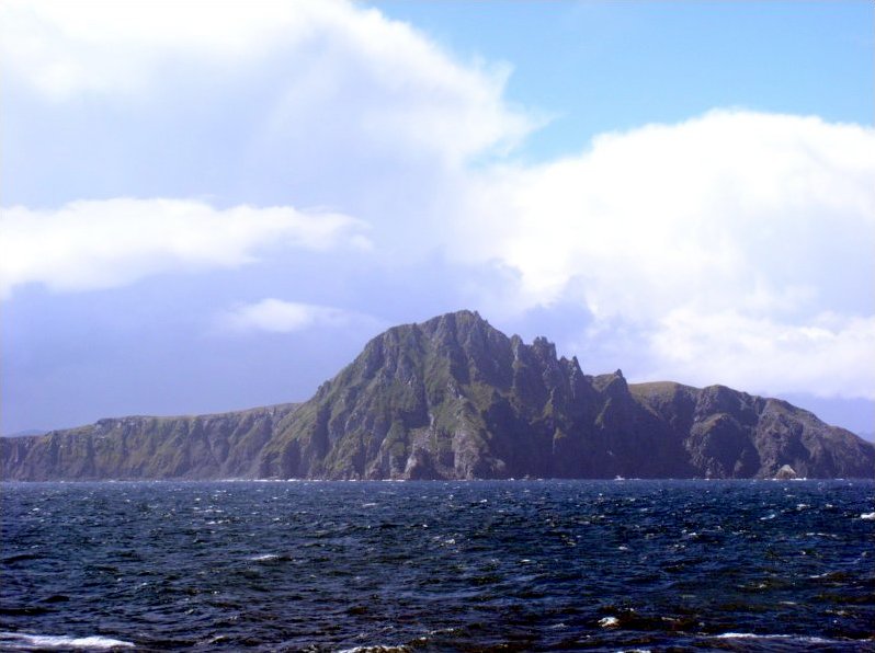 Punta Arenas, the Beagle Channel, Puerto Williams and Cape Horn
Magellan sailed this strait in 1520.
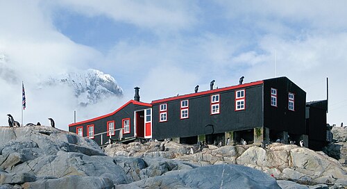 Antarctic Peninsula
A continent governed by the 1959 Antarctic Treaty, reserved for peace and science, that holds about 90% of the world’s ice.
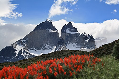 Chilean channels, Puerto Natales and Torres del Paine
RAW runs south through a maze of fjords beside the Southern Patagonian Ice Field, one of the largest bodies of ice outside the poles.
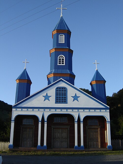 Chiloé and Puerto Montt
Chiloé is an island world with its own mythology, food and architecture.
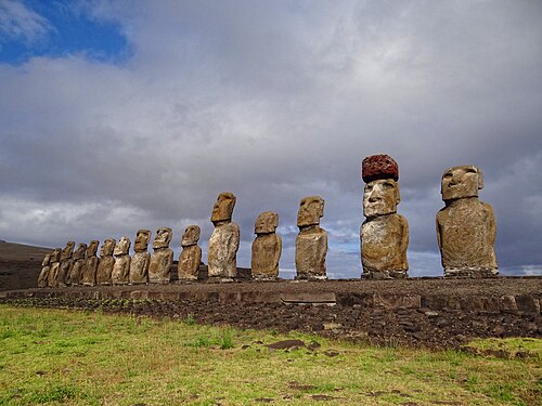 Valdivia, plus Easter Island by plane
Valdivia, a river city in the southern rainforest, was struck in 1960 by the strongest earthquake ever recorded (magnitude 9.5).
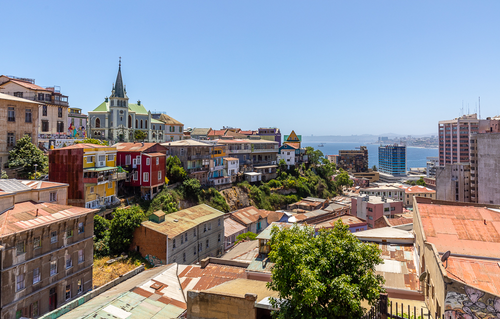 Valparaíso
A port city spread over about 40 hills around a bay, linked by funiculars and stairways (UNESCO, 2003).
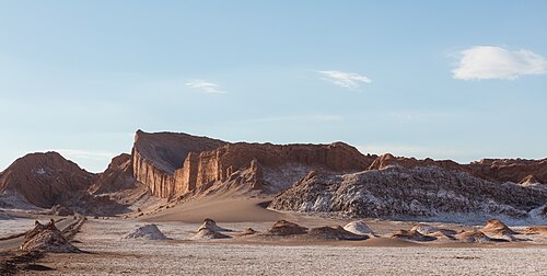 Northern ChileArica, La Serena and the Atacama
The Atacama is the driest non-polar desert on earth and has some of the clearest skies for astronomy.
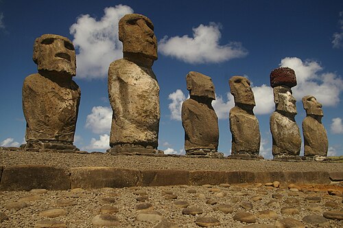 Easter Island and Pitcairn
The loneliest inhabited places on Earth: Rapa Nui, two thousand miles from anywhere, and Pitcairn, a rock with about forty people.
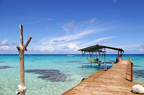 TuamotusFakarava, Rangiroa
The largest chain of atolls in the world, about 76 rings of coral around lagoons.
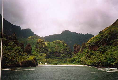 MarquesasNuku Hiva, Hiva Oa, Fatu Hiva
Steep volcanic islands with almost no fringing reef, among the most remote in the world.
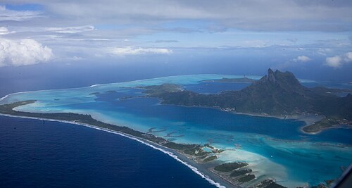 Society IslandsTahiti, Moorea, Huahine, Raiatea, Taha’a, Bora Bora
High volcanic islands ringed by lagoons, and the cultural heart of East Polynesia.
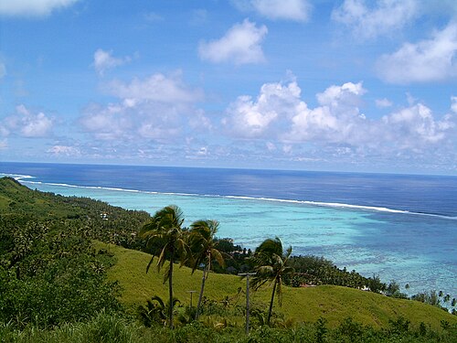 Cook IslandsRarotonga, Aitutaki
Fifteen islands scattered across about 2 million km² of ocean, self-governing in free association with New Zealand.
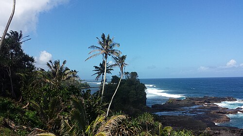 Samoa and Wallis
The heart of Polynesia, where the old order of chiefs, family and church is strongest.
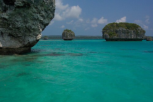 Vanuatu and New Caledonia
Two neighbours in Melanesia: Vanuatu, eighty islands and a hundred languages, and New Caledonia, a French territory inside the largest lagoon in the world.
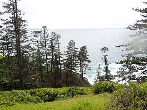 Norfolk Island
A green volcanic island alone between New Zealand, New Caledonia and Australia, five miles long, ringed by cliffs and crowned by the pines that carry its name.
Buenos Aires
The city of tango (UNESCO, shared with Montevideo), shaped by waves of European immigration, and one of the world’s great café and bookshop cities.
Puerto Madryn, Península Valdés and Gaiman
Península Valdés (UNESCO) is one of the great marine wildlife sites of the world.
Punta Arenas, the Beagle Channel, Puerto Williams and Cape Horn
Magellan sailed this strait in 1520.
Antarctic Peninsula
A continent governed by the 1959 Antarctic Treaty, reserved for peace and science, that holds about 90% of the world’s ice.
Chilean channels, Puerto Natales and Torres del Paine
RAW runs south through a maze of fjords beside the Southern Patagonian Ice Field, one of the largest bodies of ice outside the poles.
Chiloé and Puerto Montt
Chiloé is an island world with its own mythology, food and architecture.
Valdivia, plus Easter Island by plane
Valdivia, a river city in the southern rainforest, was struck in 1960 by the strongest earthquake ever recorded (magnitude 9.5).
Valparaíso
A port city spread over about 40 hills around a bay, linked by funiculars and stairways (UNESCO, 2003).
Northern ChileArica, La Serena and the Atacama
The Atacama is the driest non-polar desert on earth and has some of the clearest skies for astronomy.
Easter Island and Pitcairn
The loneliest inhabited places on Earth: Rapa Nui, two thousand miles from anywhere, and Pitcairn, a rock with about forty people.
TuamotusFakarava, Rangiroa
The largest chain of atolls in the world, about 76 rings of coral around lagoons.
MarquesasNuku Hiva, Hiva Oa, Fatu Hiva
Steep volcanic islands with almost no fringing reef, among the most remote in the world.
Society IslandsTahiti, Moorea, Huahine, Raiatea, Taha’a, Bora Bora
High volcanic islands ringed by lagoons, and the cultural heart of East Polynesia.
Cook IslandsRarotonga, Aitutaki
Fifteen islands scattered across about 2 million km² of ocean, self-governing in free association with New Zealand.
Samoa and Wallis
The heart of Polynesia, where the old order of chiefs, family and church is strongest.
Vanuatu and New Caledonia
Two neighbours in Melanesia: Vanuatu, eighty islands and a hundred languages, and New Caledonia, a French territory inside the largest lagoon in the world.
Norfolk Island
A green volcanic island alone between New Zealand, New Caledonia and Australia, five miles long, ringed by cliffs and crowned by the pines that carry its name.
Australia
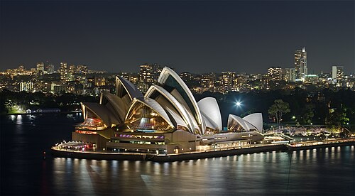 Sydney and Lord Howe Island
One of the great natural harbours of the world, twelve miles of bays between sandstone headlands, with a city of five million on its shores.
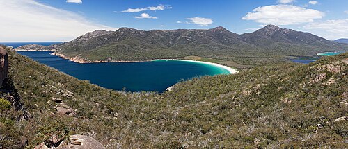 Tasmania
An island at the edge of the Roaring Forties, a fifth of it wilderness.
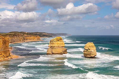 Melbourne, Adelaide and Kangaroo Island
The two southern capitals and the coast between them: a city of laneways, a city of festivals, and an island of wildlife.
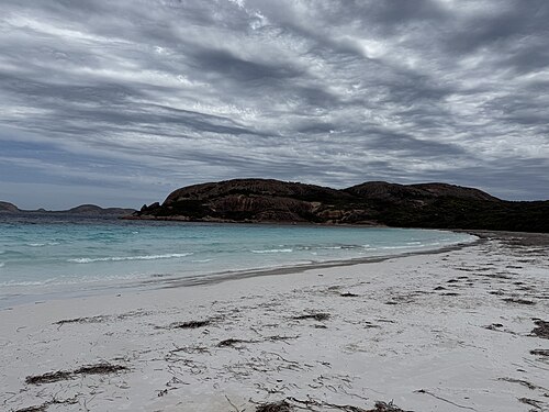 South-west Australiathe Bight to Fremantle
The emptiest coast RAW will see: cliffs without a harbour for a thousand miles, then a corner of forest, granite and white sand.
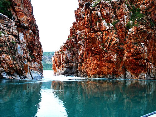 Ningaloo and the Kimberley
The north-west of Australia: a coral reef that touches the shore, and beyond it a thousand miles of red coast with no road to it.
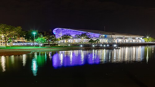 Darwin and the Top End
The tropical capital of the Australian north, closer to Indonesia than to Sydney.
Sydney and Lord Howe Island
One of the great natural harbours of the world, twelve miles of bays between sandstone headlands, with a city of five million on its shores.
Tasmania
An island at the edge of the Roaring Forties, a fifth of it wilderness.
Melbourne, Adelaide and Kangaroo Island
The two southern capitals and the coast between them: a city of laneways, a city of festivals, and an island of wildlife.
South-west Australiathe Bight to Fremantle
The emptiest coast RAW will see: cliffs without a harbour for a thousand miles, then a corner of forest, granite and white sand.
Ningaloo and the Kimberley
The north-west of Australia: a coral reef that touches the shore, and beyond it a thousand miles of red coast with no road to it.
Darwin and the Top End
The tropical capital of the Australian north, closer to Indonesia than to Sydney.
Indonesia and the Indian Ocean
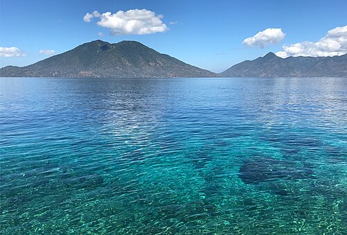 Timor, Alor and Sumba
The dry south-eastern islands of Indonesia, nearer in landscape to Australia than to Bali.
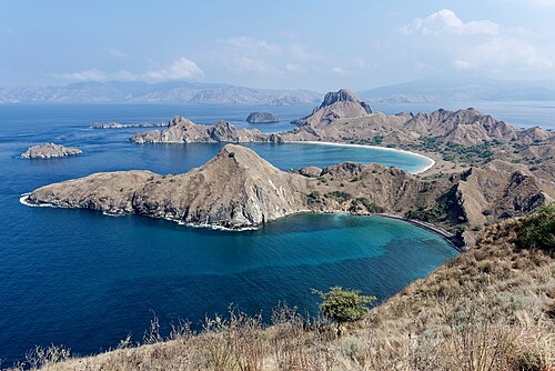 Komodo, Lombok and Bali
The line where Asia ends and Australasia begins runs between Bali and Lombok.
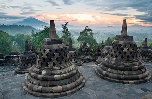 Java and the Sunda Strait
The most populous island on Earth, a chain of volcanoes with a hundred and fifty million people at their feet.
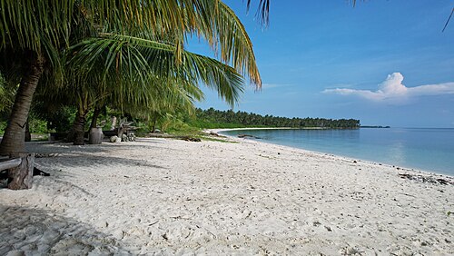 SumatraPadang to Sabang
The wild west coast of Sumatra, open to the whole Indian Ocean, with a chain of islands offshore.
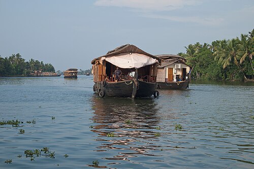 KeralaKochi and the backwaters
The green south-west coast of India, a strip of palms, lagoons and canals between the mountains and the sea.
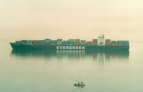 Oman, the Red Sea and Suez
The old sea road from India to the Mediterranean: the frankincense coast of Oman, the Gulf of Aden and the Red Sea.
Timor, Alor and Sumba
The dry south-eastern islands of Indonesia, nearer in landscape to Australia than to Bali.
Komodo, Lombok and Bali
The line where Asia ends and Australasia begins runs between Bali and Lombok.
Java and the Sunda Strait
The most populous island on Earth, a chain of volcanoes with a hundred and fifty million people at their feet.
SumatraPadang to Sabang
The wild west coast of Sumatra, open to the whole Indian Ocean, with a chain of islands offshore.
KeralaKochi and the backwaters
The green south-west coast of India, a strip of palms, lagoons and canals between the mountains and the sea.
Oman, the Red Sea and Suez
The old sea road from India to the Mediterranean: the frankincense coast of Oman, the Gulf of Aden and the Red Sea.
The Mediterranean and home
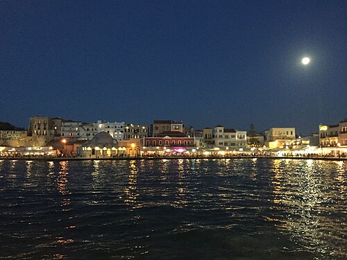 Crete
The largest Greek island, and the first land of Europe on the way home from the east.
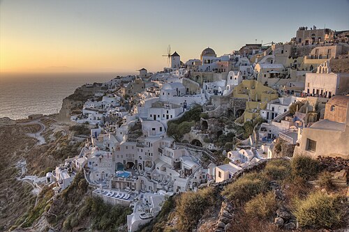 CycladesDelos, Mykonos, Naxos, Santorini
Delos, the mythical birthplace of Apollo, was a sanctuary and a huge free port; today it is uninhabited and nobody may stay overnight (UNESCO).
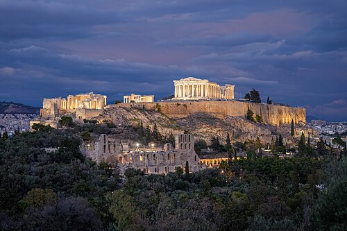 Athens and the Corinth Canal
The Acropolis (UNESCO) is the founding monument of Western architecture.
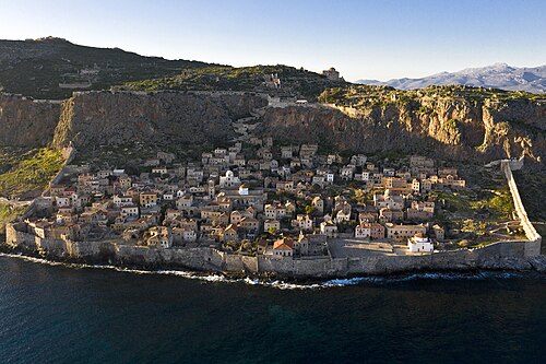 PeloponneseMonemvasia, Nafplio, Olympia
Monemvasia, whose name means “single entrance”, is a fortified Byzantine town on a rock island linked to the mainland by a causeway, with no cars inside its walls.
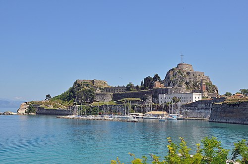 Corfu and the Ionian Islands
Corfu was ruled by Venice from 1386 to 1797 and never fell to the Ottomans, then passed through French and British hands.
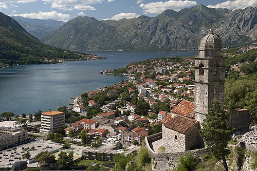 MontenegroKotor
The Bay of Kotor, a drowned river canyon often called Europe’s southernmost fjord, is a UNESCO site of mountains, walled towns and island churches.
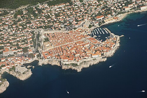 DalmatiaDubrovnik, Split and the islands
A coast of a thousand islands and stone towns, on the clearest water of the Mediterranean.
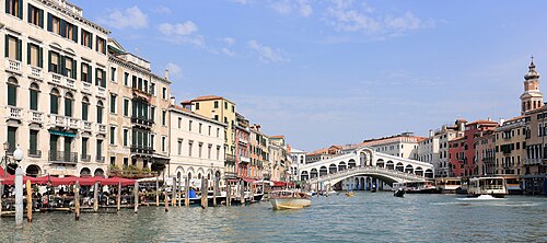 Venice and Ravenna
A city built on water by seafarers, to be reached from the sea.
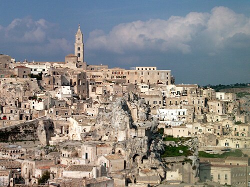 Puglia and Matera
Matera’s Sassi, cave dwellings carved into a ravine, are among the oldest continuously inhabited places in the world.
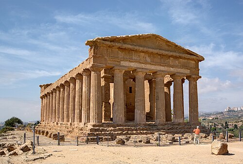 SicilySyracuse, Noto, Agrigento, Palermo
An island at the crossroads of the Mediterranean, where Greek, Roman, Arab, Norman and Spanish cultures each left masterpieces.
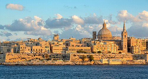 Malta and Gozo
Malta’s megalithic temples, such as Ġgantija on Gozo (around 3600 BC), are older than Stonehenge and the pyramids.
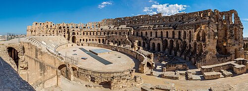 TunisiaMonastir, El Jem, Kairouan, Carthage, Sidi Bou Said
Carthage, founded by the Phoenicians in 814 BC, was Rome’s great rival until its destruction in 146 BC.
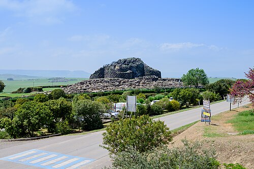 Sardinia
About 7,000 nuraghi, Bronze Age stone towers, cover the island.
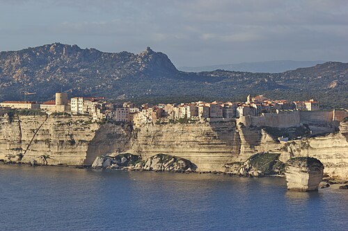 Corsica
A mountain in the sea, with peaks of two and a half thousand metres an hour from the beach.
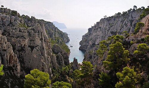 Marseille, the Costa Brava and Barcelona
The north-west corner of the Mediterranean, where the mistral blows: France’s oldest city and Spain’s most inventive one.
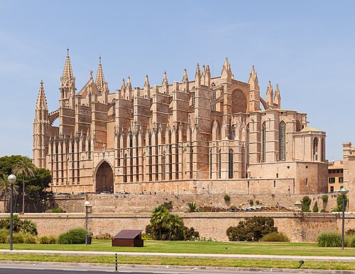 BalearicsPalma and Menorca
Menorca is a UNESCO biosphere reserve, and its Talayotic prehistoric sites were inscribed on the UNESCO list in 2023, including the taulas, T-shaped stone monuments found nowhere else.
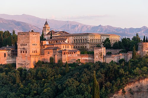 AndalusiaMálaga and Granada
The Alhambra (UNESCO) is the finest surviving palace of Al-Andalus, the Muslim civilisation that ruled much of Spain from 711 to 1492.
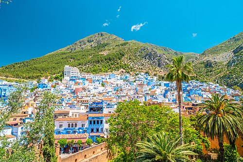 Gibraltar and northern MoroccoTétouan, Chefchaouen
At the Strait of Gibraltar, Europe and Africa are about 14 km apart, the ancient Pillars of Hercules.
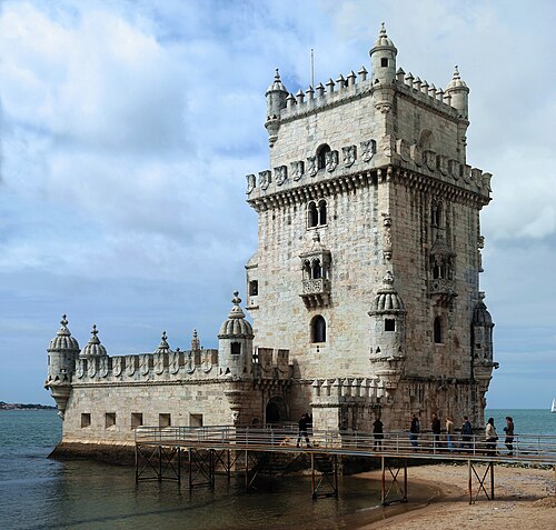 Lisbon
A city of hills, light and tiles that was destroyed by the earthquake, tsunami and fire of 1755 and rebuilt as one of the first modern planned cities in Europe.
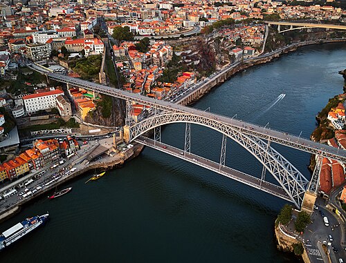 Porto and the Douro Valley
Porto’s historic centre (UNESCO) climbs steeply from the river, and the Douro Valley upstream is one of the oldest demarcated wine regions in the world (1756), a landscape of terraced vineyards (UNESCO).
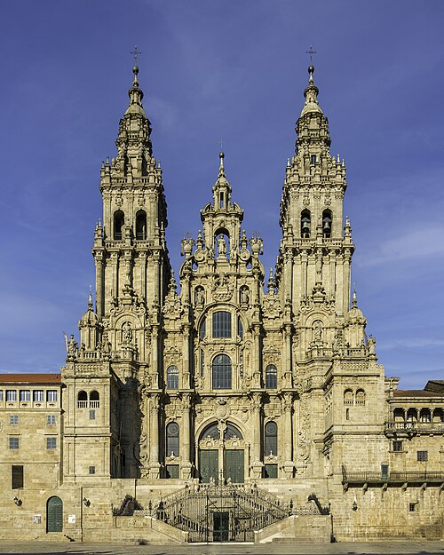 GaliciaA Coruña and Santiago de Compostela
A Coruña’s Tower of Hercules, from the 2nd century AD, is the oldest Roman lighthouse still in use (UNESCO).
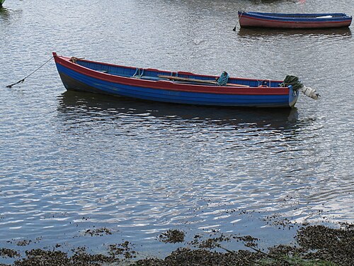 Ireland and the Isle of Man
An island of green fields behind grey cliffs.
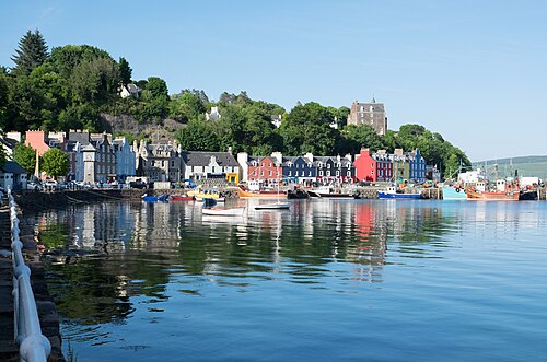 Scotlandthe Hebrides and the Great Glen
The west coast of Scotland: islands, sea lochs and tides, then a canal that crosses the country through its greatest valley.
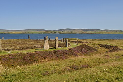 Orkney
The Heart of Neolithic Orkney (UNESCO) is one of the richest Stone Age landscapes in Europe, and current excavations at the Ness of Brodgar keep revealing more.
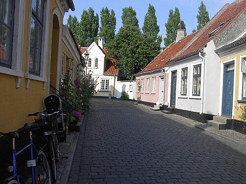 Denmarkthe Limfjord and the islands
A country of four hundred islands.
Crete
The largest Greek island, and the first land of Europe on the way home from the east.
CycladesDelos, Mykonos, Naxos, Santorini
Delos, the mythical birthplace of Apollo, was a sanctuary and a huge free port; today it is uninhabited and nobody may stay overnight (UNESCO).
Athens and the Corinth Canal
The Acropolis (UNESCO) is the founding monument of Western architecture.
PeloponneseMonemvasia, Nafplio, Olympia
Monemvasia, whose name means “single entrance”, is a fortified Byzantine town on a rock island linked to the mainland by a causeway, with no cars inside its walls.
Corfu and the Ionian Islands
Corfu was ruled by Venice from 1386 to 1797 and never fell to the Ottomans, then passed through French and British hands.
MontenegroKotor
The Bay of Kotor, a drowned river canyon often called Europe’s southernmost fjord, is a UNESCO site of mountains, walled towns and island churches.
DalmatiaDubrovnik, Split and the islands
A coast of a thousand islands and stone towns, on the clearest water of the Mediterranean.
Venice and Ravenna
A city built on water by seafarers, to be reached from the sea.
Puglia and Matera
Matera’s Sassi, cave dwellings carved into a ravine, are among the oldest continuously inhabited places in the world.
SicilySyracuse, Noto, Agrigento, Palermo
An island at the crossroads of the Mediterranean, where Greek, Roman, Arab, Norman and Spanish cultures each left masterpieces.
Malta and Gozo
Malta’s megalithic temples, such as Ġgantija on Gozo (around 3600 BC), are older than Stonehenge and the pyramids.
TunisiaMonastir, El Jem, Kairouan, Carthage, Sidi Bou Said
Carthage, founded by the Phoenicians in 814 BC, was Rome’s great rival until its destruction in 146 BC.
Sardinia
About 7,000 nuraghi, Bronze Age stone towers, cover the island.
Corsica
A mountain in the sea, with peaks of two and a half thousand metres an hour from the beach.
Marseille, the Costa Brava and Barcelona
The north-west corner of the Mediterranean, where the mistral blows: France’s oldest city and Spain’s most inventive one.
BalearicsPalma and Menorca
Menorca is a UNESCO biosphere reserve, and its Talayotic prehistoric sites were inscribed on the UNESCO list in 2023, including the taulas, T-shaped stone monuments found nowhere else.
AndalusiaMálaga and Granada
The Alhambra (UNESCO) is the finest surviving palace of Al-Andalus, the Muslim civilisation that ruled much of Spain from 711 to 1492.
Gibraltar and northern MoroccoTétouan, Chefchaouen
At the Strait of Gibraltar, Europe and Africa are about 14 km apart, the ancient Pillars of Hercules.
Lisbon
A city of hills, light and tiles that was destroyed by the earthquake, tsunami and fire of 1755 and rebuilt as one of the first modern planned cities in Europe.
Porto and the Douro Valley
Porto’s historic centre (UNESCO) climbs steeply from the river, and the Douro Valley upstream is one of the oldest demarcated wine regions in the world (1756), a landscape of terraced vineyards (UNESCO).
GaliciaA Coruña and Santiago de Compostela
A Coruña’s Tower of Hercules, from the 2nd century AD, is the oldest Roman lighthouse still in use (UNESCO).
Ireland and the Isle of Man
An island of green fields behind grey cliffs.
Scotlandthe Hebrides and the Great Glen
The west coast of Scotland: islands, sea lochs and tides, then a canal that crosses the country through its greatest valley.
Orkney
The Heart of Neolithic Orkney (UNESCO) is one of the richest Stone Age landscapes in Europe, and current excavations at the Ness of Brodgar keep revealing more.
Denmarkthe Limfjord and the islands
A country of four hundred islands.
Letters from aboard
We write when there is something to tell: from Vilnius now, later from aboard and from sea. On the day we leave, you hear first.