RAW Logbook Preparation · Marsden Cove Marina35°50′S 174°28′E 21:06 UTC+13 178 days to go // Members

Work in progress We prepare and add to this site every day. A lot is still missing, but it will be finished before we set sail.

Chapter 05 / 09

The Caribbean and Brazil

Out of the Chesapeake when the hurricane season is over, to Bermuda and a month in Antigua. In the dry season we go down the islands to Grenada and on to Suriname and French Guiana, then make the one hard passage of the plan, east along the north coast of Brazil. Salvador, Rio and Paraty follow, and the southern winter in Uruguay.

Period
Nov 2031 – Jun 2032
Distance
6,850 nm (12,700 km)
Places
9
Status
Planned
06.1

Chart

Squares are places — click to open
Ctrl + scroll or pinch to zoom · drag to movePinch with two fingers to zoom · drag to move
130°W120°W110°W100°W90°W80°W70°W60°W50°W40°W30°W20°W10°W0°10°E20°E40°S30°S20°S10°S10°N20°N30°N40°NTROPIC OF CANCERTROPIC OF CAPRICORNEQUATORBermudaAntiguaMartinique to Grenada and TobagoThe GuianasNorth-east BrazilSalvadorRio de JaneiroIlha Grande and ParatyUruguay
Ch. 05The Caribbean and Brazil9 places on this chart. Hover a square to read, click to open.Nov 2031 – Jun 2032 · 6,850 nm

The radar turns as RAW’s own does: 24 turns a minute, one every 2.5 seconds.

06.1a

Stops and stays

Planned dates for each stop in this chapter
DatesStopStayPassage
10 Nov – 13 Nov Washington by the Potomac 3 d 30 nm · 60 kmafter 0 d at sea
18 Nov – 25 Nov Bermuda 7 d 830 nm · 1,540 kmafter 5 d at sea
1 Dec – 28 Dec Antigua: English Harbour 4 wk 950 nm · 1,760 kmafter 6 d at sea
28 Dec – 30 Dec Barbuda and Montserrat 2 d 40 nm · 70 kmafter 0 d at sea
31 Dec 2031 – 12 Jan 2032 Guadeloupe, Les Saintes and Dominica 12 d 140 nm · 260 kmafter 1 d at sea
13 Jan – 25 Jan Martinique 12 d 80 nm · 150 kmafter 1 d at sea
25 Jan – 27 Jan St Lucia: the Pitons 2 d 50 nm · 90 kmafter 0 d at sea
28 Jan – 20 Feb The Grenadines and Grenada 3 wk 110 nm · 200 kmafter 1 d at sea
21 Feb – 24 Feb Tobago 3 d 110 nm · 200 kmafter 1 d at sea
27 Feb – 6 Mar Suriname: Paramaribo 8 d 540 nm · 1,000 kmafter 3 d at sea
8 Mar – 20 Mar French Guiana: the Îles du Salut and Kourou 12 d 230 nm · 430 kmafter 2 d at sea
30 Mar – 22 Apr Paraíba: Jacaré, João Pessoa and Olinda 3 wk 1,350 nm · 2,500 kmafter 10 d at sea
26 Apr – 10 May Salvador 14 d 450 nm · 830 kmafter 4 d at sea
12 May – 14 May The Abrolhos Islands, Brazil 2 d 350 nm · 650 kmafter 2 d at sea
17 May – 19 May Búzios and Ilhabela 2 d 390 nm · 720 kmafter 3 d at sea
20 May – 25 May Rio de Janeiro 5 d 90 nm · 170 kmafter 1 d at sea
26 May – 4 Jun Ilha Grande and Paraty 9 d 70 nm · 130 kmafter 1 d at sea
7 Jun – 13 Jun Santa Catarina: Florianópolis 6 d 350 nm · 650 kmafter 3 d at sea
18 Jun – 20 Oct Uruguay: Colonia, Montevideo, Punta del Este 4 moWinter break 700 nm · 1,300 kmafter 5 d at sea

Planned dates, not bookings. Passages at a cruising 8 knots, about 190 nm a day, with days added for weather windows; distances are stop to stop. We leave between 1 and 31 May 2027, when the weather and everything else allow. The dates that follow move with the day we cast off.

06.2

Itinerary

When · route · distance · culture and history
WhenRouteDistanceCulture and history
Nov 2031–Mar 2032Washington by the Potomac → Bermuda → Antigua, Guadeloupe and Dominica → Martinique to Grenada and Tobago → The Guianas~3,100 nm (~5,750 km)
Mar–Oct 2032Paraíba → Salvador → Rio de Janeiro → Paraty → Uruguay~3,750 nm (~6,950 km)
Leg total~6,850 nm (12,700 km)
06.3

Places

9 places in this chapter
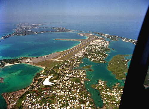
053 Bermuda Bermuda Nov 2031
32°23′N 64°41′W
A hook of low islands alone in the western Atlantic, on the northernmost coral reefs in the world.
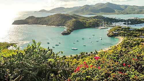
054 Antigua, Guadeloupe and Dominica Antigua, Guadeloupe and Dominica Dec 2031–Jan 2032
17°00′N 61°46′W
The northern arc of the Lesser Antilles: a low coral island, a French volcanic one and Dominica, the wildest and least developed of the chain.
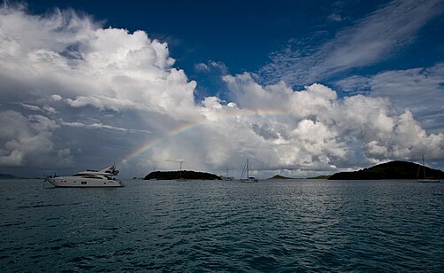
055 Martinique to Grenada and Tobago Martinique to Grenada and Tobago Jan–Feb 2032
12°28′N 61°29′W
The southern arc of the chain: steep green islands a day apart, and between them the Grenadines, thirty small islands behind reefs.
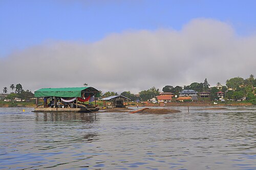
056 The Guianas The GuianasSuriname and French Guiana Feb–Mar 2032
5°17′N 52°35′W
The forgotten coast of South America: brown rivers, mangrove and unbroken forest.
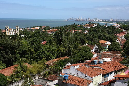
057 North-east Brazil North-east BrazilParaíba and Olinda Mar–Apr 2032
7°02′S 34°52′W
The easternmost corner of the Americas, where the continent turns south.
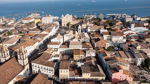
058 Salvador Salvador Apr–May 2032
12°58′S 38°30′W
Brazil’s first capital (1549–1763) and the heart of Afro-Brazilian culture, often called the most African city outside Africa.
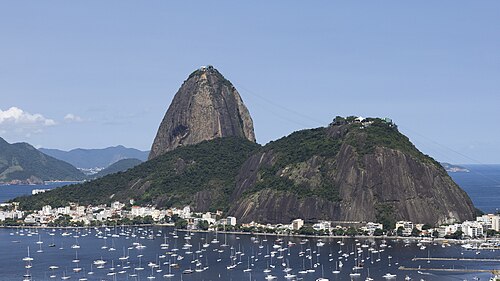
059 Rio de Janeiro Rio de Janeiro May 2032
22°55′S 43°10′W
In 2012, Rio became the first city landscape on the UNESCO list, for the way mountains, forest and sea shape the city.
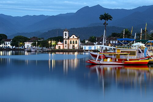
060 Ilha Grande and Paraty Ilha Grande and Paraty May–Jun 2032
23°13′S 44°43′W
Paraty and Ilha Grande were Brazil’s first mixed cultural and natural UNESCO site (2019), joining a colonial town with Atlantic rainforest and islands.
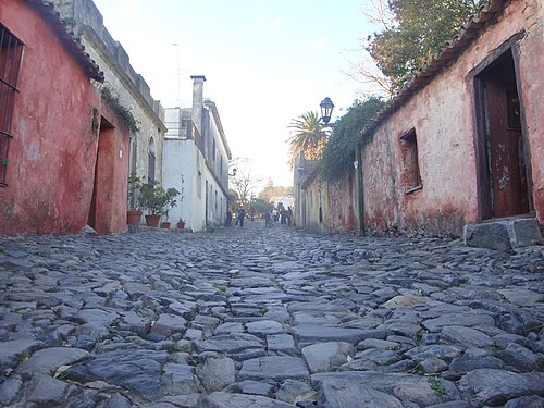
061 Uruguay UruguayColonia, Montevideo, Punta del Este Jun–Oct 2032
34°28′S 57°50′W
Colonia del Sacramento, founded by the Portuguese in 1680 and fought over by Spain for a century, is a UNESCO site.