RAW Logbook Preparation · Marsden Cove Marina35°50′S 174°28′E 21:06 UTC+13 178 days to go // Members

Work in progress We prepare and add to this site every day. A lot is still missing, but it will be finished before we set sail.

Chapter 06 / 09

Patagonia, Antarctica and the Pacific

Down the coast of Patagonia to the Beagle Channel and across to the Antarctic Peninsula in January 2033. We come north through the Chilean channels and winter at Valdivia, then cross the Pacific with the trade wind: Easter Island, Pitcairn, the Marquesas, Tahiti for the Heiva, Samoa and Fiji. In November 2034 RAW is back in Whangarei, the harbour she was built in, having gone round the world.

Period
Oct 2032 – Nov 2034
Distance
15,250 nm (28,250 km)
Places
17
Status
Planned
06.1

Chart

Squares are places — click to open
Ctrl + scroll or pinch to zoom · drag to movePinch with two fingers to zoom · drag to move
150°E180°150°W120°W90°W60°W60°S30°S30°NTROPIC OF CANCERTROPIC OF CAPRICORNANTARCTIC CIRCLEEQUATORBuenos AiresPuerto MadrynPunta ArenasAntarctic PeninsulaChilean channelsChiloé and Puerto MonttValdiviaValparaísoNorthern ChileEaster Island and PitcairnTuamotusMarquesasSociety IslandsCook IslandsSamoa and WallisVanuatu and New CaledoniaNorfolk Island
Ch. 06Patagonia, Antarctica and the Pacific17 places on this chart. Hover a square to read, click to open.Oct 2032 – Nov 2034 · 15,250 nm

The radar turns as RAW’s own does: 24 turns a minute, one every 2.5 seconds.

06.1a

Stops and stays

Planned dates for each stop in this chapter
DatesStopStayPassage
22 Oct – 26 Oct Mar del Plata 4 d 230 nm · 430 kmafter 2 d at sea
29 Oct – 8 Nov Península Valdés, Puerto Madryn 10 d 450 nm · 830 kmafter 3 d at sea
10 Nov – 14 Nov Puerto Deseado and the Patagonian coast 4 d 330 nm · 610 kmafter 2 d at sea
18 Nov 2032 – 8 Jan 2033 Beagle Channel, Puerto Williams, Cape Horn 7 wk 560 nm · 1,040 kmafter 4 d at sea
12 Jan – 14 Jan Deception Island 2 d 610 nm · 1,130 kmafter 4 d at sea
15 Jan – 4 Feb Antarctic Peninsula 20 d 160 nm · 300 kmafter 1 d at sea
8 Feb – 13 Feb Puerto Williams 5 d 600 nm · 1,110 kmafter 4 d at sea
1 Mar – 7 Mar The channels northbound: Puerto Edén to Laguna San Rafael 6 d 950 nm · 1,760 kmafter 16 d at sea
10 Mar – 24 Mar Chiloé and Puerto Montt 14 d 300 nm · 560 kmafter 3 d at sea
26 Mar – 5 Oct Valdivia 6½ moWinter break 200 nm · 370 kmafter 2 d at sea
8 Oct – 22 Oct Valparaíso and Santiago 14 d 450 nm · 830 kmafter 3 d at sea
24 Oct – 30 Oct La Serena and Coquimbo 6 d 200 nm · 370 kmafter 2 d at sea
2 Nov – 9 Nov Juan Fernández: Robinson Crusoe Island 7 d 470 nm · 870 kmafter 3 d at sea
18 Nov – 8 Dec Easter Island (Rapa Nui) 20 d 1,640 nm · 3,040 kmafter 9 d at sea
15 Dec – 18 Dec Pitcairn Island 3 d 1,120 nm · 2,070 kmafter 7 d at sea
20 Dec 2033 – 20 Jan 2034 The Gambier Islands 4 wk 290 nm · 540 kmafter 2 d at sea
25 Jan – 20 Apr The Marquesas: Fatu Hiva, Hiva Oa and Nuku Hiva 3 mo 800 nm · 1,480 kmafter 5 d at sea
24 Apr – 20 May The Tuamotus: Hao, Makemo and Fakarava 4 wk 550 nm · 1,020 kmafter 4 d at sea
22 May – 20 Jul Tahiti and Moorea 8 wk 250 nm · 460 kmafter 2 d at sea
21 Jul – 23 Jul Huahine and Maupiti 2 d 120 nm · 220 kmafter 1 d at sea
23 Jul – 2 Aug Raiatea, Taha‘a and Bora Bora 10 d 30 nm · 60 kmafter 0 d at sea
5 Aug – 11 Aug Rurutu, the Austral Islands 6 d 350 nm · 650 kmafter 3 d at sea
15 Aug – 21 Aug The Cook Islands: Aitutaki and Rarotonga 6 d 500 nm · 930 kmafter 4 d at sea
23 Aug – 25 Aug Palmerston Atoll 2 d 310 nm · 570 kmafter 2 d at sea
29 Aug – 5 Sep Samoa: Apia and Savai‘i 7 d 650 nm · 1,200 kmafter 4 d at sea
7 Sep – 9 Sep Wallis and Futuna 2 d 300 nm · 560 kmafter 2 d at sea
12 Sep – 18 Sep Savusavu, seven years on 6 d 390 nm · 720 kmafter 3 d at sea
20 Sep – 25 Sep Suva 5 d 140 nm · 260 kmafter 2 d at sea
26 Sep – 2 Oct Kadavu and the Great Astrolabe Reef 6 d 55 nm · 100 kmafter 1 d at sea
2 Oct – 4 Oct Beqa 2 d 40 nm · 70 kmafter 0 d at sea
6 Oct – 14 Oct Yasawa and Mamanuca islands 8 d 110 nm · 200 kmafter 2 d at sea
14 Oct – 18 Oct Vuda Marina 4 d 45 nm · 80 kmafter 0 d at sea
21 Oct – 25 Oct Tanna, Vanuatu 4 d 470 nm · 870 kmafter 3 d at sea
26 Oct – 30 Oct Port Vila, Efate 4 d 140 nm · 260 kmafter 1 d at sea
1 Nov – 3 Nov Lifou and Ouvéa, Loyalty Islands 2 d 230 nm · 430 kmafter 2 d at sea
4 Nov – 8 Nov Nouméa, New Caledonia 4 d 110 nm · 200 kmafter 1 d at sea
9 Nov – 13 Nov Isle of Pines 4 d 60 nm · 110 kmafter 1 d at sea
16 Nov – 17 Nov Norfolk Island 1 d 450 nm · 830 kmafter 3 d at sea
20 Nov – 22 Nov The Bay of Islands 2 d 560 nm · 1,040 kmafter 3 d at sea
22 Nov 2034 – 3 Jan 2035 Whangarei: the circle closes 6 wk 50 nm · 90 kmafter 0 d at sea

Planned dates, not bookings. Passages at a cruising 8 knots, about 190 nm a day, with days added for weather windows; distances are stop to stop. We leave between 1 and 31 May 2027, when the weather and everything else allow. The dates that follow move with the day we cast off.

06.2

Itinerary

When · route · distance · culture and history
WhenRouteDistanceCulture and history
Oct 2032–Feb 2033Mar del Plata → Península Valdés → Beagle Channel and Cape Horn → Antarctic Peninsula → Beagle Channel and Cape Horn~2,950 nm (~5,450 km)
Mar–Oct 2033Chilean channels → Chiloé → Valdivia → Valparaíso → La Serena~2,100 nm (~3,900 km)
Nov 2033–May 2034Valparaíso → Easter Island and Pitcairn → Tuamotus → Marquesas → Tuamotus~4,850 nm (~9,000 km)
May–Nov 2034Tahiti and the Society Islands → Cook Islands → Samoa and Wallis → Fiji → Vanuatu and New Caledonia~4,300 nm (~7,950 km)
Nov 2034–Jan 2035Norfolk Island → Whangarei~1,050 nm (~1,950 km)
Leg total~15,250 nm (28,250 km)
06.3

Places

17 places in this chapter
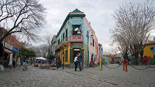
062 Buenos Aires Buenos Aires Oct 2032
34°36′S 58°23′W
The city of tango (UNESCO, shared with Montevideo), shaped by waves of European immigration, and one of the world’s great café and bookshop cities.
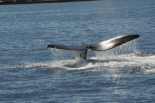
063 Puerto Madryn, Península Valdés and Gaiman Puerto Madryn, Península Valdés and Gaiman Oct–Nov 2032
42°46′S 65°02′W
Península Valdés (UNESCO) is one of the great marine wildlife sites of the world.
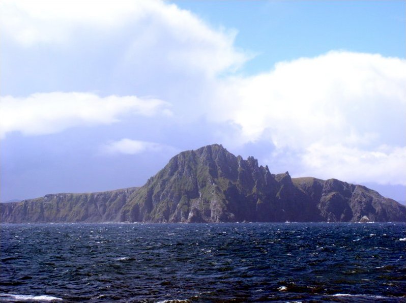
064 Punta Arenas, the Beagle Channel, Puerto Williams and Cape Horn Punta Arenas, the Beagle Channel, Puerto Williams and Cape Horn Nov 2032–Jan 2033
53°10′S 70°55′W
Magellan sailed this strait in 1520.
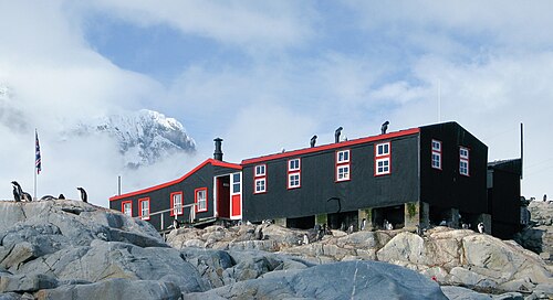
065 Antarctic Peninsula Antarctic Peninsula Jan–Feb 2033
64°50′S 63°29′W
A continent governed by the 1959 Antarctic Treaty, reserved for peace and science, that holds about 90% of the world’s ice.
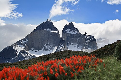
066 Chilean channels, Puerto Natales and Torres del Paine Chilean channels, Puerto Natales and Torres del Paine Mar 2033
51°44′S 72°31′W
RAW runs south through a maze of fjords beside the Southern Patagonian Ice Field, one of the largest bodies of ice outside the poles.
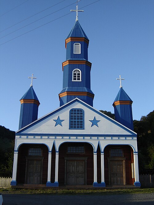
067 Chiloé and Puerto Montt Chiloé and Puerto Montt Mar 2033
42°29′S 73°46′W
Chiloé is an island world with its own mythology, food and architecture.
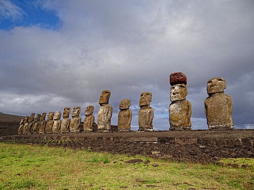
068 Valdivia, plus Easter Island by plane Valdivia, plus Easter Island by plane Mar–Oct 2033
39°49′S 73°15′W
Valdivia, a river city in the southern rainforest, was struck in 1960 by the strongest earthquake ever recorded (magnitude 9.5).
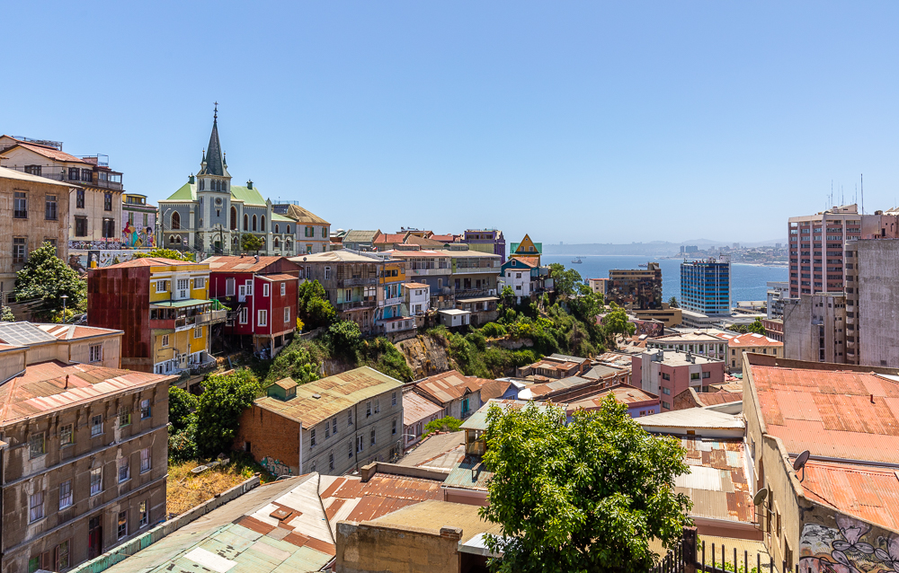
069 Valparaíso Valparaíso Oct 2033
33°03′S 71°37′W
A port city spread over about 40 hills around a bay, linked by funiculars and stairways (UNESCO, 2003).
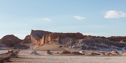
070 Northern Chile Northern ChileArica, La Serena and the Atacama Oct 2033
18°29′S 70°19′W
The Atacama is the driest non-polar desert on earth and has some of the clearest skies for astronomy.
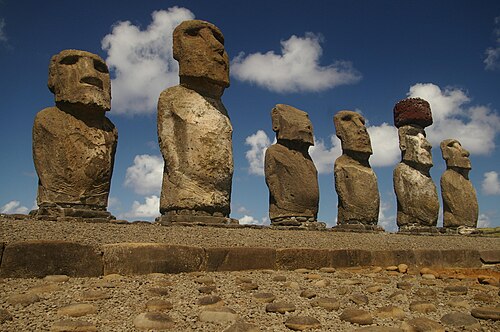
071 Easter Island and Pitcairn Easter Island and Pitcairn Nov–Dec 2033
27°09′S 109°26′W
The loneliest inhabited places on Earth: Rapa Nui, two thousand miles from anywhere, and Pitcairn, a rock with about forty people.
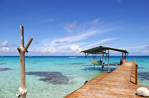
072 Tuamotus TuamotusFakarava, Rangiroa Dec 2033–Jan 2034
16°03′S 145°37′W
The largest chain of atolls in the world, about 76 rings of coral around lagoons.
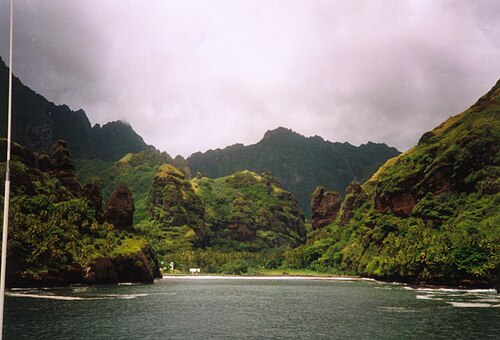
073 Marquesas MarquesasNuku Hiva, Hiva Oa, Fatu Hiva Jan–Apr 2034
8°55′S 140°06′W
Steep volcanic islands with almost no fringing reef, among the most remote in the world.
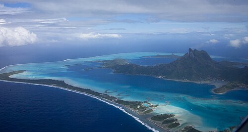
074 Society Islands Society IslandsTahiti, Moorea, Huahine, Raiatea, Taha’a, Bora Bora May–Aug 2034
17°32′S 149°34′W
High volcanic islands ringed by lagoons, and the cultural heart of East Polynesia.
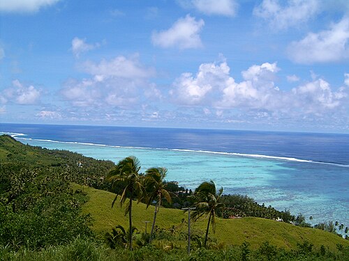
075 Cook Islands Cook IslandsRarotonga, Aitutaki Aug 2034
21°13′S 159°47′W
Fifteen islands scattered across about 2 million km² of ocean, self-governing in free association with New Zealand.
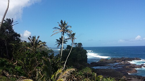
076 Samoa and Wallis Samoa and Wallis Aug–Sep 2034
13°50′S 171°46′W
The heart of Polynesia, where the old order of chiefs, family and church is strongest.
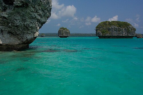
077 Vanuatu and New Caledonia Vanuatu and New Caledonia Oct–Nov 2034
17°44′S 168°19′E
Two neighbours in Melanesia: Vanuatu, eighty islands and a hundred languages, and New Caledonia, a French territory inside the largest lagoon in the world.
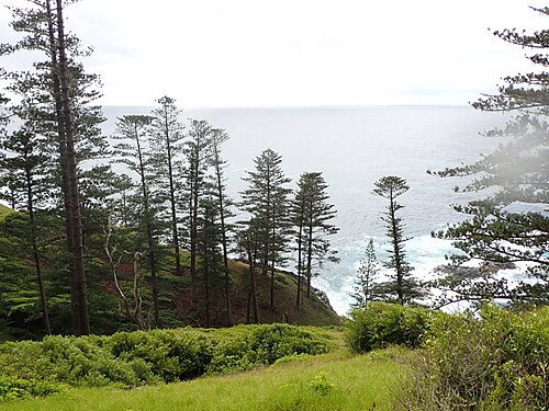
078 Norfolk Island Norfolk Island Nov 2034
29°03′S 167°57′E
A green volcanic island alone between New Zealand, New Caledonia and Australia, five miles long, ringed by cliffs and crowned by the pines that carry its name.
06.4

Along the way

Moments in this chapter
January 2033 Antarctic Peninsula The height of the southern summer on the ice Ch. 06
July 2034 Tahiti Heiva i Tahiti, the festival of Polynesian dance and sport Ch. 06
19 November 2034 Whangarei RAW comes back to the harbour she was built in: the circle round the world closes Ch. 06