RAW Logbook Preparation · Marsden Cove Marina35°50′S 174°28′E 21:06 UTC+13 178 days to go // Members

Work in progress We prepare and add to this site every day. A lot is still missing, but it will be finished before we set sail.

Place 015 / 115

Tohoku and Hokkaido

Hakodate

Chapter
02 · Japan and the China seas
When
May–Aug 2028
Position
41°46′N 140°44′E
Status
Planned
Tohoku and Hokkaido
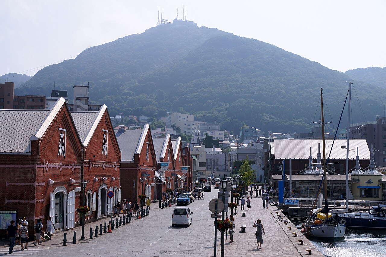
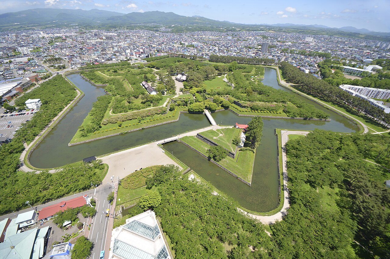
Fig. 015.1 Tohoku and Hokkaido Reference photograph, before RAW arrives. Photo: 663highland · CC BY 2.5 · Wikimedia Commons
Why it’s unique01
Culture and history02
Placemaking03
Diving and water04
Photography05

01 Why it’s unique

The Sanriku coast of Tohoku was devastated by the tsunami of March 2011 and has since been rebuilt in very different ways, making it an open-air study of recovery. Hokkaido is Japan’s northern frontier and the homeland of the Ainu.

02 Culture and history

Culture and history: Tohoku and Hokkaido
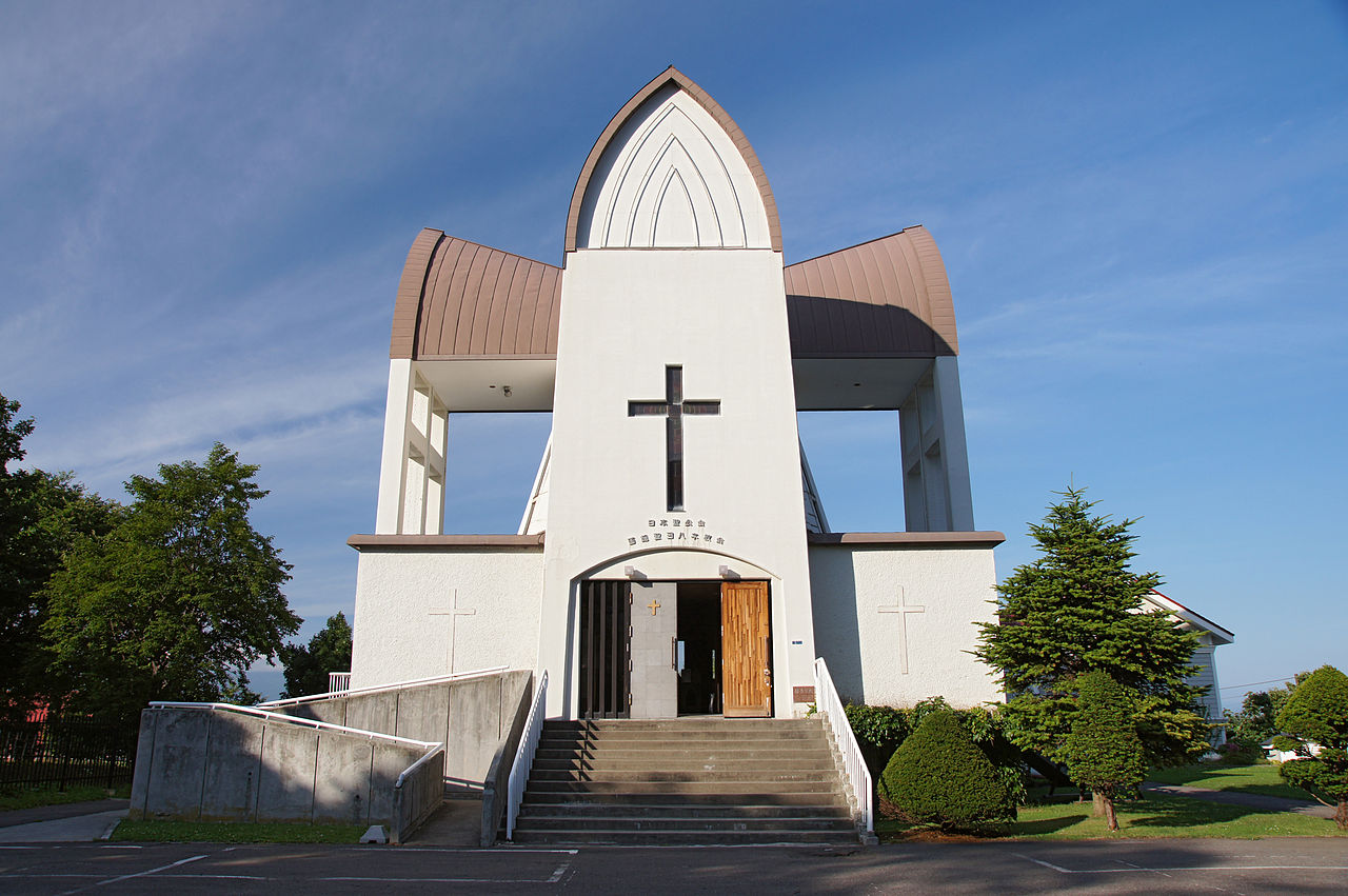
Fig. 015.2 Photo: 663highland · CC BY 2.5 · Wikimedia Commons

Hakodate was one of Japan’s first ports opened to foreign trade in 1859; its Motomachi district keeps a Russian Orthodox church and Western-style houses on the hillside. Goryokaku, a star-shaped Western-style fort (1864), saw the last battle of the Boshin War in 1869. The Ainu, the Indigenous people of Hokkaido, were formally recognised by Japan in 2019, and Upopoy, the National Ainu Museum and Park, opened at Shiraoi in 2020.

03 Placemaking

Placemaking: Tohoku and Hokkaido
Fig. 015.3 Photo: 掬茶 · CC BY-SA 4.0 · Wikimedia Commons

After 2011, towns chose different paths. Many built seawalls more than 10 m high; Rikuzentakata raised the ground of its new centre by about 10 m and built a memorial park around its “miracle pine”, the one tree that survived; Onagawa chose no seawall at all, rebuilding a car-free shopping street that runs straight down to the harbour. In Hakodate, red-brick warehouses on the waterfront have been reused as shops and restaurants, next to the busy morning market.

04 Diving and water

Diving and water: Tohoku and Hokkaido
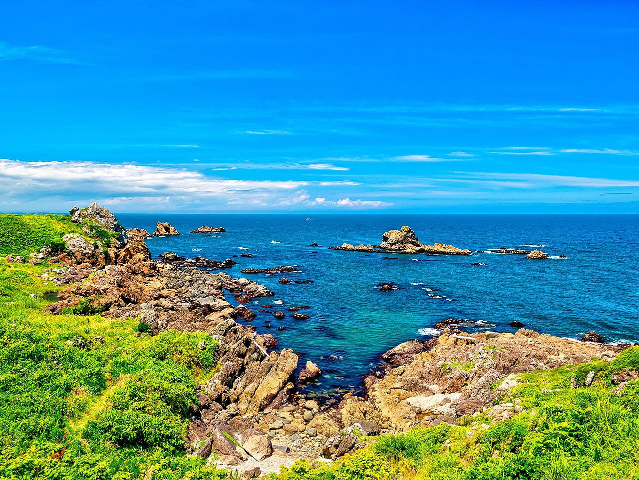
Fig. 015.4 Photo: くろふね · CC BY 4.0 · Wikimedia Commons

Cold water and little dive infrastructure; drysuit only.

05 Photography

Photography: Tohoku and Hokkaido
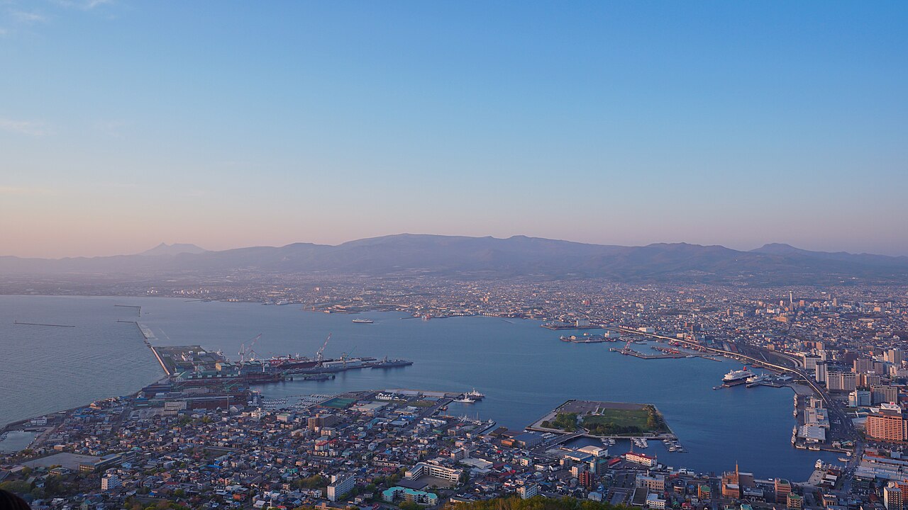
Fig. 015.5 Photo: Goryokaku-Tower · CC BY 4.0 · Wikimedia Commons

Hakodate’s night view from Mount Hakodate; Goryokaku from its tower; restored fishing ports along the Sanriku coast.

Text: the voyage plan, last updated 04.11.2026. Places and timings may change with the weather and circumstances.

Are you here?

Meet us in Tohoku and Hokkaido

We plan to be here in May–Aug 2028. If you live here, sail nearby or know this place well, we would like to hear from you before we arrive.

Local knowledge

From people who know Tohoku and Hokkaido

No tips yet. If you know this place, tell others what not to miss: a person, a workshop, an anchorage, a festival, a walk.

Share what you know

A small task before sending, so we know you are a person.

We read each tip before it appears here. Privacy